When it comes to urban development, it’s helpful to make use of WMS providers with…

MapSavvy: A Powerful Conservation Planning Software Tool
When it comes to looking for a conservation planning software tool, web mapping services that provide aerial imagery are a critical component in conservation planning programs. More specifically, MapSavvy.com is a conservation planning software tool that should be on every conservation planner’s radar because it provides the most affordable source of aerial imagery on the market today.
MapSavvy: A Necessary Conservation Planning Software Tool
As web mapping has come on line offering access to aerial imagery, conservation professionals have embraced this technology as a necessary conservation planning software tool.
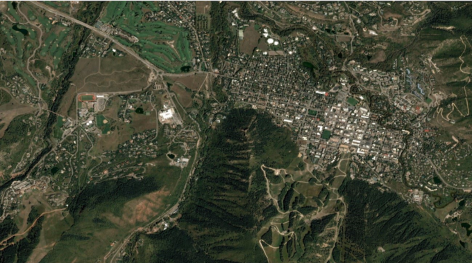
Simply put, web mapping offers access to aerial imagery of the earth from a variety of sources, in a variety of “vintages” (i.e., WHEN the images were shot). Web mapping services can then display the imagery in a variety of layers to provide visual information needed for research, business & government applications. Aerial imagery obtained from web mapping services is a potent tool in assessing landscapes in order to deploy strategic conservation planning.
Conservation Software Planning Tools Help Building “Greenprints”
“Greenprints,” also known as landscape conservation plans, help conservation professionals make strategic decisions. Greenprints are visual maps that provide insights into a specific area’s topography, bodies of water & wetland areas, vegetation, forestation, and more.
Aerial imagery from web mapping services can be used to understand the attributes of a specific area, in order to develop meaningful & realistic conservation plans.
Some aerial imagery needed for conservation planning is available for free through government agencies. But the free aerial imagery doesn’t always provide a full picture of an area because some government-supplied aerial imagery is more than 10 years old.
That’s where a conservation planning software tool like MapSavvy comes into play. MapSavvy is unique in that it provides a variety of “vintages” of aerial images of the same targeted area.
In order to develop meaningful conservation plans, conservation & natural resource professionals need to see how an area has changed over time, either because of storms, natural disasters, climate change, and/or development & infrastructure. Free government images often provide a view of an aerial a decade ago, or more. The MapSavvy web mapping service provides original aerial imagery of the world shot in 2011; 2017 aerial imagery; and 2019 aerial imagery.
By comparing the various vintages of aerial imagery of an area being studied for conservation, professionals & researchers have a clearer picture of how an area has changed over time. This provides valuable insights that can be incorporated into a conservation plan.
MapSavvy: The Most Affordable Conservation Planning Software Tool on the Market
It’s no secret that conservation programs don’t always have the funding they need. As a result, it’s more important than ever to deploy conservation planning software tools that are affordable.
MapSavvy.com from USA-based OnTerra Systems is literally the most affordable web mapping service on the market today. MapSavvy costs just $500 for a user license that supports up to 5 users. Under this license, the five users can each access up to 4,000 WMS requests per year (total of 20,000 WMS requests per year). Volume discounts are available for more than 10 users.
When it comes to conservation planning, research teams & government agencies don’t have money to waste. That’s why MapSavvy is the number one web mapping service that should be used by conservation planners.
Need to learn more about how to buy web mapping services? Check out the FREE MapSavvy Web Mapping Service Buying Guide.
Interested in a Free Trial of MapSavvy? Check out this powerful, affordable web mapping service from USA-based OnTerra Systems.
Related Posts