OnTerra Systems today announced that its MapSavvy WMS now has Google Maps layers, along with…
MapSavvy Provides Powerful, Affordable Aerial Imagery for Insurance
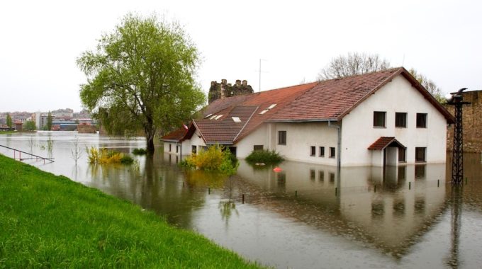
The use of aerial imagery for insurance has surged in just the past couple of years – with insurance companies now using aerial imagery in four key areas:
- Post-storm damage assessment
- Validating damage claims & streamlining the claims process
- Risk assessment
- Fraud prevention
Did You Know: Insurance Journal has reported that the insurance industry’s use of aerial imagery (from planes and/or drones) increased dramatically after 2018 saw both Hurricane Florence & Hurricane Michael pounded the east coast of the United States.
Aerial Imagery for Insurance: Damage Assessment
The insurance industry is turning to aerial imagery for its powerful ability to provide immediate damage assessment, particularly when powerful storms have caused so much damage that it’s still too dangerous for insurance underwriters to physically inspect storm-ravaged properties & lands. In the aftermath of powerful storms, flooding, downed power lines & inaccessible roads can slow down the damage assessment process. By using aerial imagery, insurance claim professionals can start the process of determining which properties have been damaged or destroyed. In these applications, aerial imagery from planes typically is used more frequently because drone operators need to be in or near storm-damaged areas to fly their drones. Planes can fly at a great height over areas hit by hurricanes, tornados & epic floods without endangering the pilot. When insurance adjusters are working on damage assessment, they need “Before” images of what an area looked like to compare with images of the storm-damaged area shot from a plane after the storm has moved on or abated. This is where MapSavvy comes into play. MapSavvy provides “Before” aerial imagery of targeted geographic areas at a fraction of the cost of many other aerial imagery services.
Aerial Imagery for Insurance: Claims Validation
Insurance companies also are using aerial imagery as a means of validating insurance claims. Most insurance companies still require an on-site inspection by an insurance adjuster. But aerial imagery obtained right after a storm can be compared with “Before” images to start the process of validating that an insurance claim is legitimate.
Aerial Imagery for Insurance: Risk Assessment
Risk assessment is another area where aerial imagery is being used more and more in the insurance industry. By utilizing aerial imagery of lands & properties from a high-altitude perspective, risk assessment professionals can analyze potential threats to specific locations & properties. For example, aerial imagery can be used to determine if a property is located in a flood plain, downstream from an aging dam, and more.
Aerial Imagery for Insurance: Fraud Prevention
When insurance companies can prevent insurance fraud, everybody wins. Preventing insurance fraud helps keep a line of rising insurance premiums. Aerial imagery for insurance can be used to determine when someone is making a false claim, or an overstated claim, of property damage after storms.
MapSavvy: A Source of Affordable Imagery for Insurance Applications
When it comes to sourcing aerial imagery for “Before” pictures, comparison shopping is the best strategy. When comparison shopping, MapSavvy emergest as the most affordable source of “Before” aerial imagery needed for business applications. Starting at just $500/year, MapSavvy offers a low entry price point that allows businesses of all sizes to buy only what’s needed. And that’s good for the insurance industry, and every other industry that makes use of aerial imagery.
Need aerial imagery for insurance applications, or other business applications? Take MapSavvy for a test drive today!
Related Posts