Aerial imagery forms the basis of today’s web mapping, and the history of aerial imagery…
WMS Providers With Current Imagery For Urban Development Applications
When it comes to urban development, it’s helpful to make use of WMS providers with current imagery, such as the MapSavvy WMS. MapSavvy now offers Google Maps aerial imagery alongside its existing Bing Maps and HERE Maps imagery. This expanded range of imagery options gives professionals working in urban development, real estate, planning, and GIS a more complete picture of what is happening on the ground, both today and in years past.
A common question users ask is: What the difference between Bing Maps, HERE Maps, and Google Maps aerial imagery? The short answer is that there is no right or wrong choice. Each imagery source serves a different purpose, and the real value comes from having access to multiple imagery sources from one WMS platform.
WMS Providers With Current Imagery: How Does Having Multiple Vintages Of Aerial Imagery Help In Urban Development?
Bing Maps aerial imagery tends to be older in many locations. For some land parcels, Bing imagery shows what the land looked like from several years ago. That sounds like a downside. But, for many users, it is exactly what they need. Older imagery provides a historical view of how a parcel of land looked at a point in the past. If you are tracking change over time, documenting prior site conditions, or comparing before and after scenarios for an urban development project, that historical perspective is essential.
Google Maps aerial imagery is generally refreshed more frequently. Google updates imagery in major metropolitan areas every one to three years, with rapidly developing or high-priority zones often receiving even faster updates. Google Maps imagery also tends to offer higher resolution, which is helpful for zooming in and inspecting site details from an overhead view.
 .
. 
WMS Providers With Current Imagery: A Comparison Of Imagery Pulled On Different Dates, From Different Mapping Options
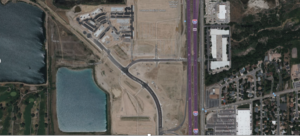
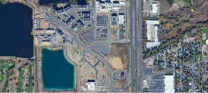
Consider the urban development example shown in the accompanying images above. The first image on the LEFT is an older Bing Maps aerial image showing a property that is only partially developed, with a limited number of buildings and a great deal of exposed earth. The second image on the RIGHT is a more recent Google Maps aerial view of the same site, showing the parcel of land is mostly built out with completed structures, paved lots, and landscaping in place. Neither view is more correct. They simply tell different parts of the story.
For urban developers, planners, surveyors, and consultants, this combination is powerful. Bing Maps imagery can show what a site looked like before development began, or in early stages of development. Google Maps imagery can show the current condition of the property and the surrounding context. HERE Maps imagery adds a third independent perspective. Side by side, the three imagery sources let you build a richer and more accurate picture of any parcel.
With Google Maps imagery now available alongside Bing Maps and HERE Maps inside MapSavvy, users have one affordable, OGC-compliant Web Map Service that delivers all three imagery perspectives from a single source. As a result, MapSavvy is one of the ideal WMS providers with current imagery – as well as imagery from past “vintages.”
Take MapSavvy for a test drive! Check out our free trial.


Related Posts