When it comes to urban development, it’s helpful to make use of WMS providers with…

The MapSavvy.com Guide To Satellite Imagery Layers
When using satellite imagery from MapSavvy.com for business, government, or research purposes, it’s important to understand that there are multiple satellite imagery layers from which to choose. The MapSavvy Guide to Satellite Imagery Layers is a short primer on the various options and how they typically are used.
MapSavvy Guide To Satellite Imagery Layers: The Basics
So let’s cover the basics first. The MapSavvy.com Web Map Service (WMS) is based on Bing Maps.
The MapSavvy.com WMS offers 5 distinct layers (options) for satellite imagery – and each imagery layer has specific uses.
The 5 imagery layers offered through MapSavvy.com include:
- Bing Road
- Bing Aerial
- Bing Aerial with Labels
- Bing Original Aerial
- Bing Original Aerial with Labels
We’ll briefly cover each of the 5 options, and explain the typical uses for each.
MapSavvy Guide To Satellite Imagery Layers: Specifics on the 5 Options
Here’s a look at the specifics of the 5 satellite imagery layers available through MapSavvy.com & how they’re typically used.
Option 1: Bing Road layer
This Road map layer shows specific details that include streets, landmarks & cities. The primary visual information contained in this layer is all about streets & boundaries between municipalities.
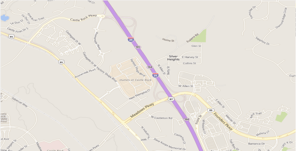
- Uses: Choose this layer when you need the geographic orientation of seeing specific streets or city boundaries.
- Applications: Architecture & city planning, infrastructure planning, road & traffic planning
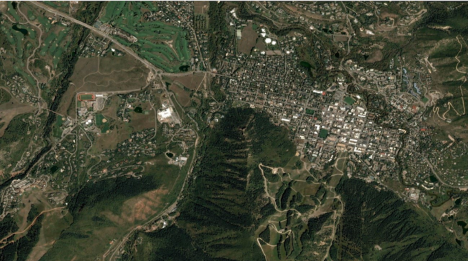
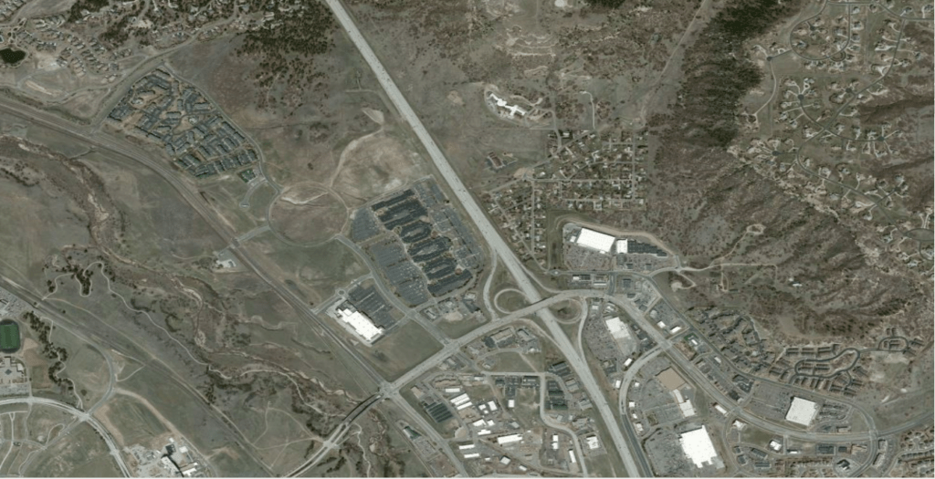
Option 2: Bing Aerial
The Bing Aerial layer shows a straight-down overhead view with no street or city information. This imagery range from 30-50 cm in resolution. Because this imagery layer doesn’t show street or city information, it’s harder to know what you’re looking at because the only reference points are the geographic terrain.
- Uses: Choose this layer when you need a pure overhead view of terrain.
- Applications: Government research
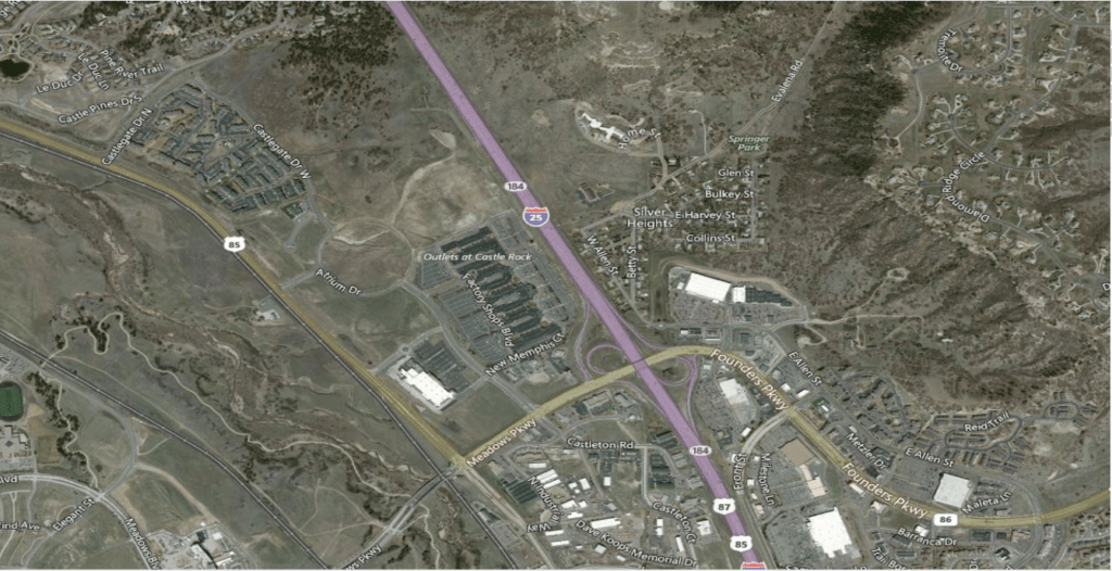
Option 3: Bing Aerial with Labels
This “hybrid” aerial imagery layer is a combination of Bing’s base aerial imagery combined with a limited amount of landmark & road data. This hybrid aerial imagery layer makes it easier to get oriented and know what you’re viewing in the context of nearby landmarks and major streets.
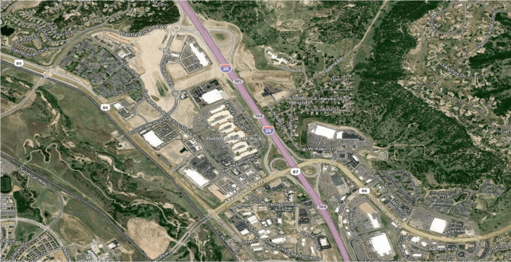
- Uses: Choose this layer when you need to view terrain but need it in the context of major roads & nearby cities.
- Applications: Wildland firefighting planning, post-storm assessment, development, pipeline planning, infrastructure & transportation planning
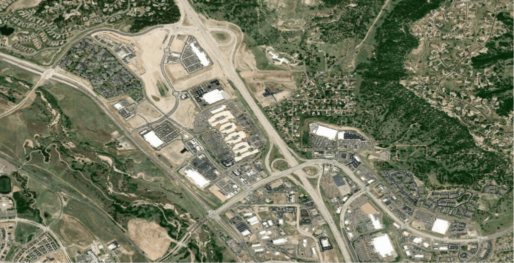
Option 4: Bing Original Aerial
This imagery layer is true aerial view of the world. To obtain these images, Bing flew the whole United States with planes to take aerial imagery. These “original” images provide a historical view of geographic areas. These images were typically shot at a relatively low altitude but have a higher resolution than the newer imagery.
- Uses: Choose this layer when you want to provide a Before-After view of an area, or you need low-altitude historical views of terrain (but higher than the 400 feet that a drone can fly), or you need higher-resolution images of an area.
- Applications: Government research, development, city planning, transportation planning
Option 5: Bing Original Aerial with Labels
This aerial imagery layer provides the original aerial images of the United States that Bing photographed from relatively low-flying planes, coupled with labels that show major streets & cities. This imagery layer has a higher resolution than the newer imagery Bing released in 2017.
- Uses: Choose this layer when you need a historical view of an area and you need the orientation of knowing what you’re seeing based on a limited set of major streets and cities included in the imagery.
- Applications: Government research, post-storm damage assessment
MapSavvy: Unique in the Market for its Satellite Imagery Layers
When it comes to finding a web mapping service to meet your needs, MapSavvy is the clear choice for three key reasons:
- Affordability: MapSavvy offers access to multiple satellite imagery layers at roughly HALF the cost of what other vendors are charging. (The starting price is $500/year.)
- Multiple Layers Available: MapSavvy literally is the only provider of Bing Maps layers as a WMS standard. Some mapping vendors offer straight aerial imagery but do not offer imagery with labels & roads for better orientation. Some mapping vendors provide only historical imagery. Some mapping vendors provide only new imagery. MapSavvy provides both historical imagery, imagery taken in 2017, and straight satellite or aerial imagery, and satellite or aerial imagery with labels.
- Visual Quality of the Imagery: If you view aerial imagery from some well-known vendors, much of it is over-exposed and hard to see detail. In contrast, the Bing team took the imagery and then processed it to offer deep, clear color saturation so you can easily see more detail in the imagery.
Want to learn tips on how to buy satellite or aerial imagery? Access the MapSavvy Web Mapping Buyihng Guide.
Interested in learning more about MapSavvy and giving it a test drive? Visit: www.MapSavvy.com, or try our Free, 14-day trial.
Related Posts