When it comes to urban development, it’s helpful to make use of WMS providers with…
MapSavvy Is An Affordable Source For Aerial Imagery For Agriculture
Aerial imagery for agriculture is fast becoming a standard practice for farmers practicing what’s now called “precision agriculture.” As a result, the MapSavvy web map service has become a powerful tool providing visual insights for farmers.
In the old days, you just tilled & plowed the fields, planted seeds, watered, and then watched the field produce crops. Now, all sorts of technologies are being applied to farming, not only to improve crop yields but for the overall management of farmland.
Aerial Imagery for Agriculture Provides Higher-altitude Views than Drone Imagery
Drones are being applied to agriculture and other industries in increasing numbers. But there are limits to what a drone can do and the images they can provide for a very simple reason: FAA regulations only allow drones to fly up to 400 feet high to keep them out of the airspace of commercial, military & private aircraft.
As a result, a drone is helpful but only provides farmers with a view from a height of 400 feet. To be able to view the contours of the land, sources of irrigation and how they relate to various fields and crops, and get an overall view of farming operations, the imagery needs to be taken from a greater height than the 400-foot limit applied to drones.
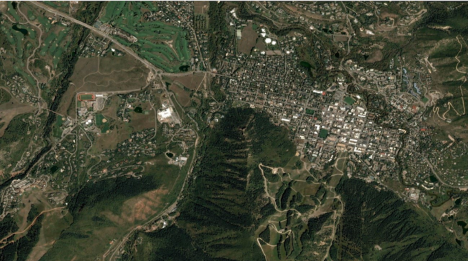
This leaves aerial imagery taken by satellites as the best option for viewing & assessing farmlands, as well as viewing the entire farm.
MapSavvy = Affordable, Multi-view Aerial Imagery Options For The Agriculture Industry
MapSavvy by USA-based OnTerra Systems offers aerial imagery from Google Maps, Bing Maps & HERE MAPS to provide one of the most affordable & effective options for those needing aerial imagery for agriculture applications.
What’s compelling about MapSavvy is that it offers the ability to view aerial images in multiple versions, or layers – and it offers the ability to go back in time and look at older aerial images, and then compare them to aerial views of the same farmlands updated by Bing Maps in 2017.
The multiple image view options offered by MapSavvy allow for comparison of older vs. updated imagery of agricultural lands to assess changes in geography, irrigation, size & path of waterways, and much more.
When combined with smart, computerized harvesting equipment that can measure crop yields by the acre to analyze high-growth and low-growth areas, farmers can gain valuable insights to improve their operations with sources of aerial imagery for agriculture like MapSavvy.
MapSavvy also allows access to aerial imagery for agriculture at prices far lower than that other options on the market. For just $999 per year, users can access up to 40,000 images.
Interested in learning more about aerial imagery for agriculture provided by MapSavvy? Visit: www.MapSavvy.com, or try our Free, 14-day trial.
Related Posts