When it comes to urban development, it’s helpful to make use of WMS providers with…

MapSavvy Web Mapping Service Serves Important Role As A Transportation Planning Technology Tool
When local, state & federal officials get involved in transportation planning, they have to use a transportation planning tool like MapSavvy to develop a transportation system that will stand the test of time.
Successful Transportation Planning Requires Ability To See the Future
Successful transportation planners have to define goals, policies, investments in transportation infrastructure and thoughtful design, and then initiate programs to build a transportation system that functions now and also meets the needs of future generations. Transportation planners must look at a variety of factors ranging from population growth, new developments that will affect traffic, demographics of the citizenry (and who drives vs. bikes vs. uses mass transit to get to work), and more.
Transportation Planning Uses 5 Key Steps
Building a successful, functioning transportation system involves 5 key steps. MapSavvy is there to move this process forward as an affordable, practical transportation planning technology tool.
The 5 key steps in transportation planning include:
- Evaluation of existing conditions of the current transportation infrastructure
- Goal setting based on forecasting population growth and anticipated developments & land use in the future
- Developing transportation plan options to solve the problems
- Evaluating options
- Developing a Long Range Transportation Plan (LRTP) & budget
When local, regional & federal transportation planners are working their magic to come up with a transportation system that meets the needs of communities for years to come, they need a transportation planning technology tool like MapSavvy. What’s more, MapSavvy is used in all 5 phases of transportation planning. Let’s take a look at how MapSavvy is used in this process.
Transportation Planning Stage 1: Evaluation
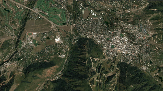
In this phase, transportation planners are reviewing the current transportation infrastructure & evaluating the most pressing problems that need to be solved. Transportation planners use MapSavvy to get the overhead imagery of the transportation infrastructure to help assess visually where and why transportation problems are occurring.
Transportation Planning Stage 2: Goal Setting
Transportation planning is an area that truly does require the ability to predict the future. In this stage, transportation planners have to project population growth, areas where new developments will add to traffic volume or the need for a new exit point on a highway, and more. Web mapping services like MapSavvy are helpful by showing the “Before” overhead view to compare with existing new developments and residential areas that have sprung up. Planners can make some educated assumptions about likely areas of growth by comparing “Before” images from MapSavvy with new aerial images.
Transportation Planning Stage 3: Developing Options
In order to effectively brainstorm options for how to fix an area’s transportation woes, transportation planners need visuals. MapSavvy is there to provide affordable aerial imagery so planners can see the problem areas and brainstorm solutions.
Transportation Planning Stage 4: Assessing & Presenting Proposed Transportation Improvements
When presenting options for alleviating transportation problems, there’s a level of civic & public engagement that must take place. In this stage, transportation system options must be presented, first to governmental officials and often, to the public as well. In these scenarios, a web mapping service like MapSavvy is used to provide visuals for presenting transportation system options. Most people understand patterns better when they can see them vs. just reading text. MapSavvy provides affordable visuals that show where the problems are, and can show where the proposed solutions would take place.
Transportation Planning Stage 5: Developing the long-range transportation plan, phasing & budget
Once options have been assessed and either accepted or discarded, the accepted transportation plan becomes part of a long-term document with phases & budgets. These documents typically become public record. As such, a long-range transportation plan will outline how the transportation project is sequenced, and should include aerial images that highlight where initial work will take place, where the next round of work will take place, etc. Aerial imagery typically becomes part of this transportation planning document. MapSavvy provides affordable aerial imagery that helps keep the cost of producing the transportation plan at a reasonable level.
Net net: Transportation planning is a complex task that requires the integration of many different elements: transportation infrastructure, anticipated growth, economic factors, and more. MapSavvy is the transportation planning technology tool of choice because it provides the aerial imagery needed at all stages, and for one of the most affordable prices on the market.
If you’re involved with transportation & infrastructure planning, and need aerial images, give MapSavvy from USA-based OnTerra Systems a try. We offer a Free Trial or Contact OnTerra Systems for more information.
Related Posts